Multi-Peril Storm Scoping for Colorado Commercial Buildings
Multi-peril storm damage documentation and repair for Denver commercial flat roofs - hail plus wind combined-loss scopes, NOAA-anchored documentation, and repair-vs-replace analysis for Front Range storm events.
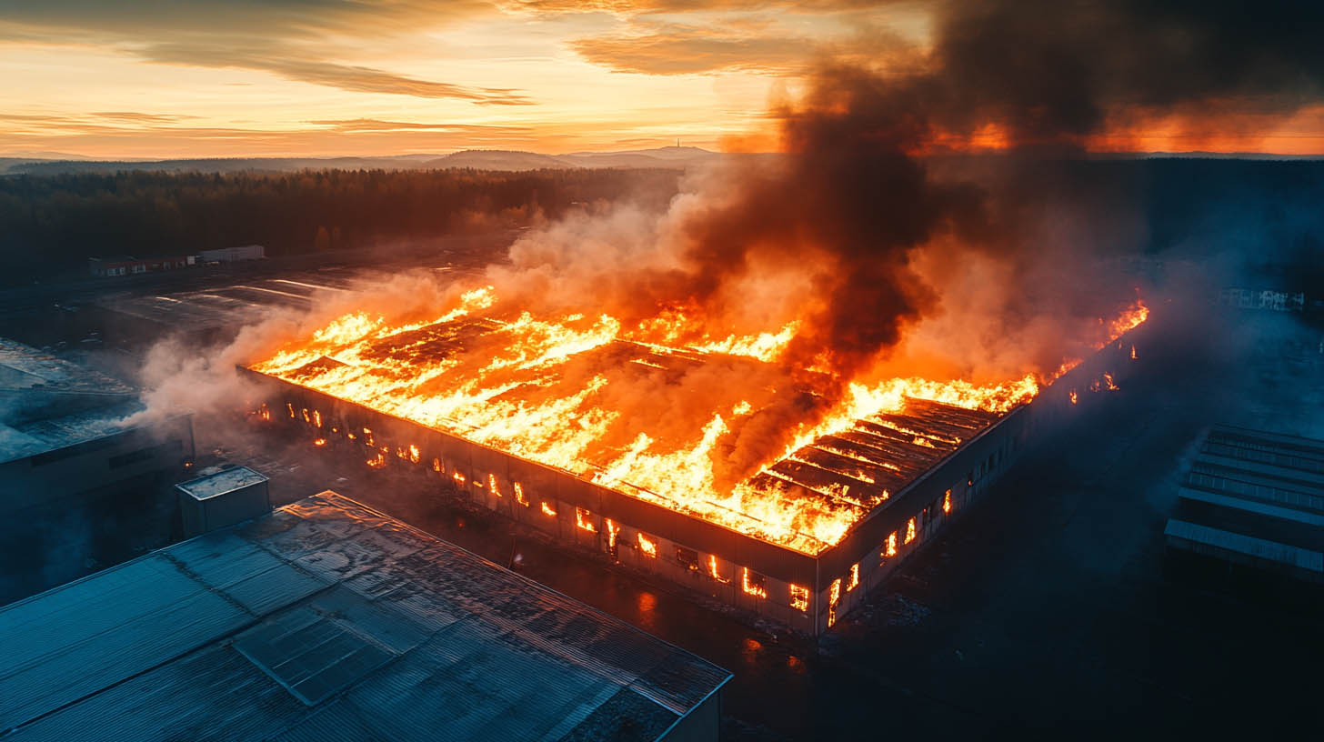
Denver's most damaging roof events are multi-peril: hail arrives with 60-mph outflow winds, ice pellets follow large stones, and the storm exits leaving a mixed damage pattern that a single-peril inspection misreads. We scope combined-loss events as the multi-peril events they are - and build documentation that reflects what actually happened on the roof.
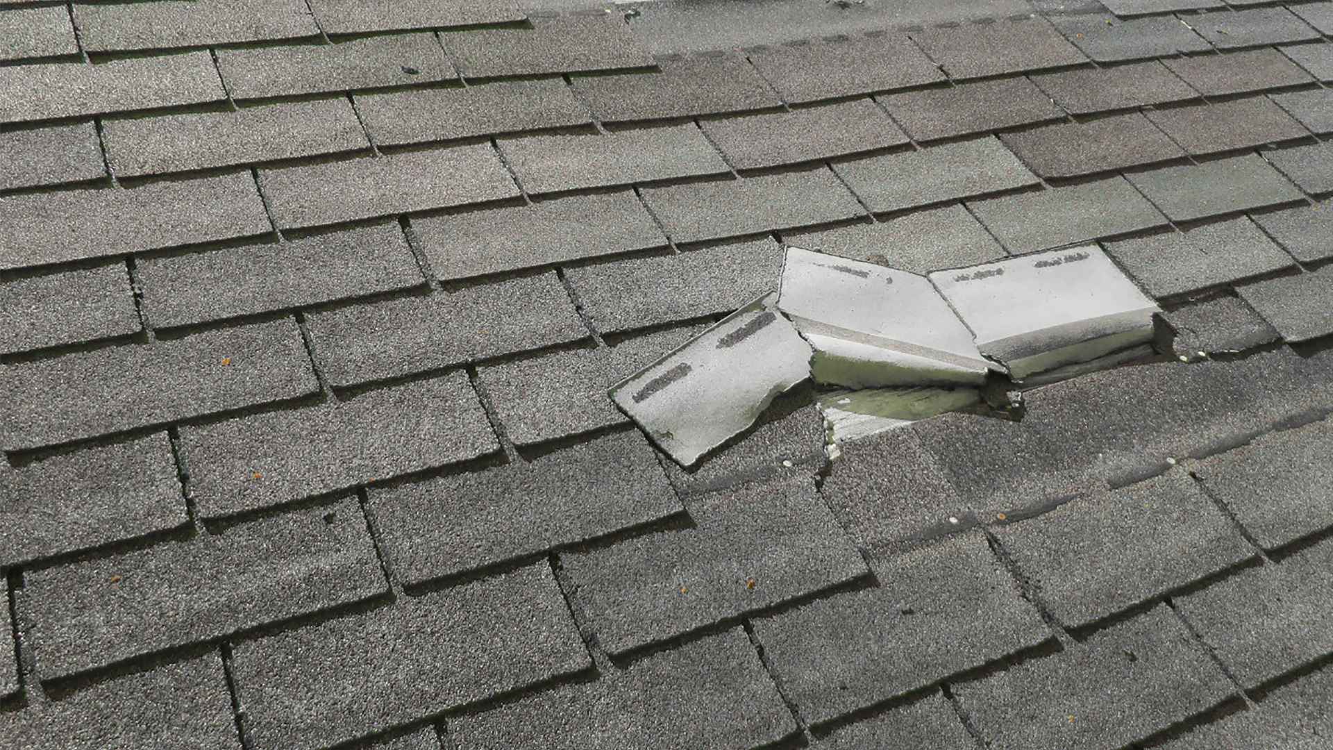
A severe Denver thunderstorm is almost never a single-peril event. The typical summer supercell crossing the Front Range from May through August combines large hail, high-velocity outflow winds, heavy rain, and sometimes rotating cells that produce brief tornado touchdowns in the eastern suburbs. Each peril leaves a distinct failure signature on a commercial flat roof - and they interact. Hail impact compromises the membrane at impact points; concurrent 60-mph outflow lifts the compromised perimeter; rain infiltrates the lifted zone before the storm exits the area. The combined-loss scope is more complex than either peril individually, and the documentation has to reflect that complexity accurately or the claim gets fragmented.
Colorado's insurance landscape for commercial property creates specific documentation demands for combined storm losses. Policies written by the major Front Range carriers - State Farm, Allstate, Farmers, American Family - typically require separate documentation for hail peril versus wind peril on the same loss event, because the two perils can be covered by different sections of the policy with different deductible structures. A scope package that conflates hail and wind damage into a single line produces adjuster review friction that delays settlement. We build documentation that separates the perils at the zone level.
After the storm, we prioritize stabilization - dry-in of open sections, temporary cover on lifted perimeter zones - and then complete the full multi-peril documentation package. The package separates hail damage zones, wind-damage zones, combined-peril zones, and any pre-existing condition from all of the above. That structure is what lets a Colorado adjuster or public adjuster work the claim efficiently.
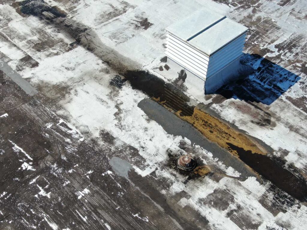
The June through August Denver supercell season routinely produces events where the hail footprint and the wind-damage footprint overlap but do not match. Hail damage concentrates where the storm track produced the largest stones - typically a northeast-moving band one to three miles wide. Wind damage from the same storm concentrates at corner and perimeter zones based on the building's orientation relative to the outflow direction. A building on the north edge of the hail band may have significant wind damage from the storm's leading outflow and minimal hail impact. A building at the storm core may have both perils at high severity.
We map both perils separately onto the roof zone diagram during the inspection. Hail zones are identified by impact pattern, stone-size correlation to NOAA storm data, and core-sample results. Wind zones are identified by fastener pullout evidence, seam edge lift pattern, and edge metal displacement. The intersection zones where both perils occurred simultaneously are documented as combined-loss zones with separate notation for each peril's contribution. That zone-level separation is what a Colorado adjuster needs to apply the policy structure correctly.
Post-storm sequencing matters in Denver because the hail season can produce multiple events in rapid succession - two or three documented hail events across the same Adams County zip code in a single June. We timestamp and NOAA-anchor every inspection to a specific event so the documentation is attributable to a specific storm date, not a general condition. When multiple events have hit the same building in a season, we document each separately and note any pre-existing damage that predates the claimed event.
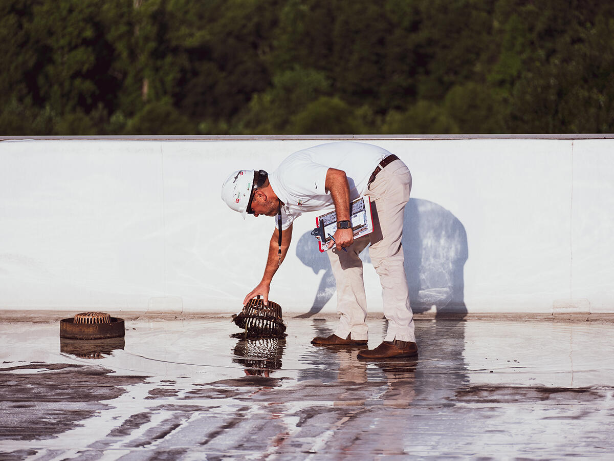
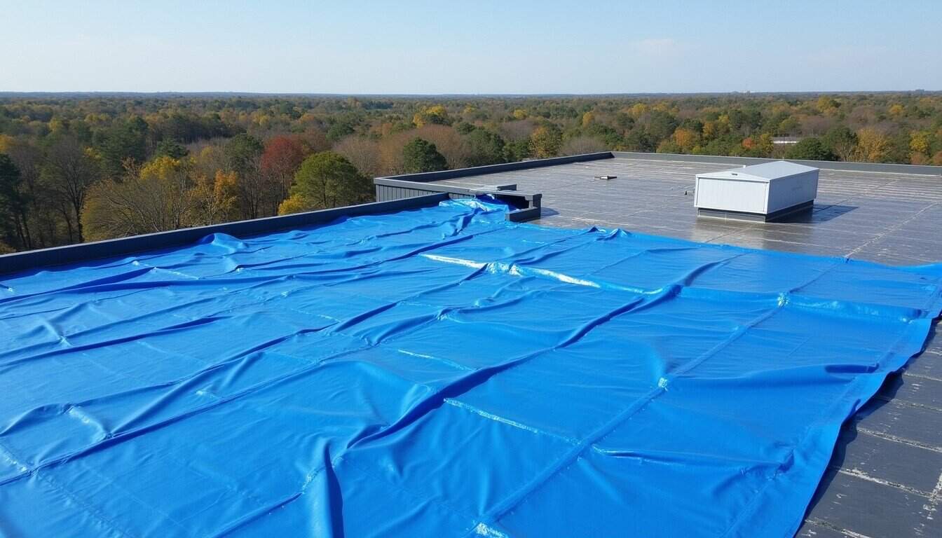
When a severe Denver storm produces active infiltration through lifted membrane sections or punctured zones, temporary stabilization precedes full documentation. The priority is stopping water entry before Denver's afternoon monsoon pattern - common in July and August - delivers another inch of rain on an already compromised roof. We mobilize emergency dry-in crews for storm events that produce acute damage, with same-day response available for buildings on our maintenance contracts.
Temporary stabilization is scoped and photographed as an independent work item. Every temporary action - mechanically fastened cover board over lifted zones, peel-and-stick membrane patch over punctures, edge metal re-termination at displaced perimeter details - is documented before and after with timestamped photos. The temporary scope is invoiced and documented separately from the storm damage scope so neither document creates ambiguity for the claim or for the permanent repair scope that follows.
After stabilization, we complete the full multi-peril documentation: zone diagram with peril separation, photo log with GPS tags, core samples in bruising-suspect zones, NOAA storm data cross-reference, and the written repair-vs-replace recommendation that accounts for pre-storm condition separately from storm-attributable damage.
Colorado commercial property policies often have different deductible structures and coverage sections for hail peril versus wind peril. We build the documentation package with zone-level peril separation - hail zones, wind zones, combined-peril zones - so the adjuster can apply the policy structure at the zone level. A single combined-damage line item causes review friction and often delays settlement. Zone-level separation moves the claim faster.
| Scope Format | Written roof plan and photo record |
|---|---|
| Primary Market | Denver commercial buildings |