A Better Way to Look at a Quarter-Million Square Feet of Roof
Drone roof inspection in Denver, CO.
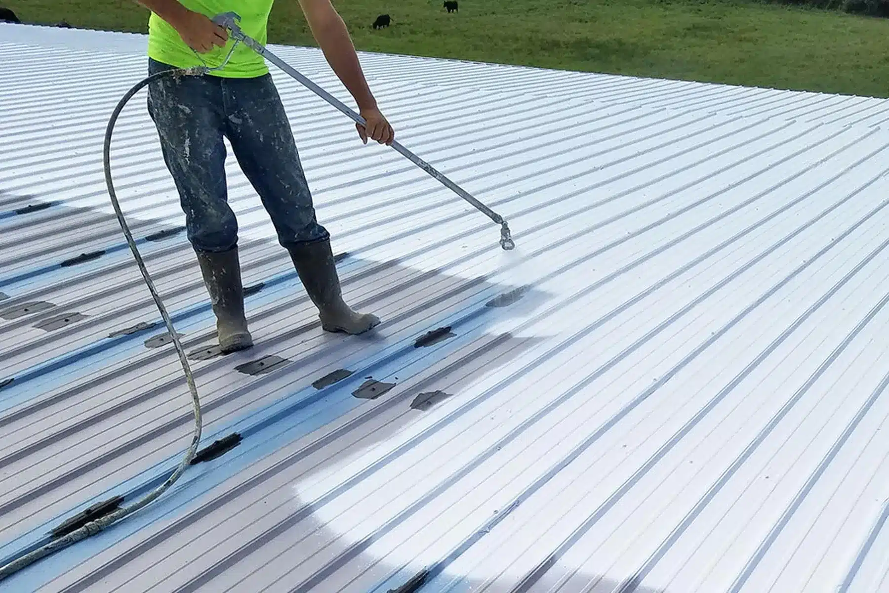
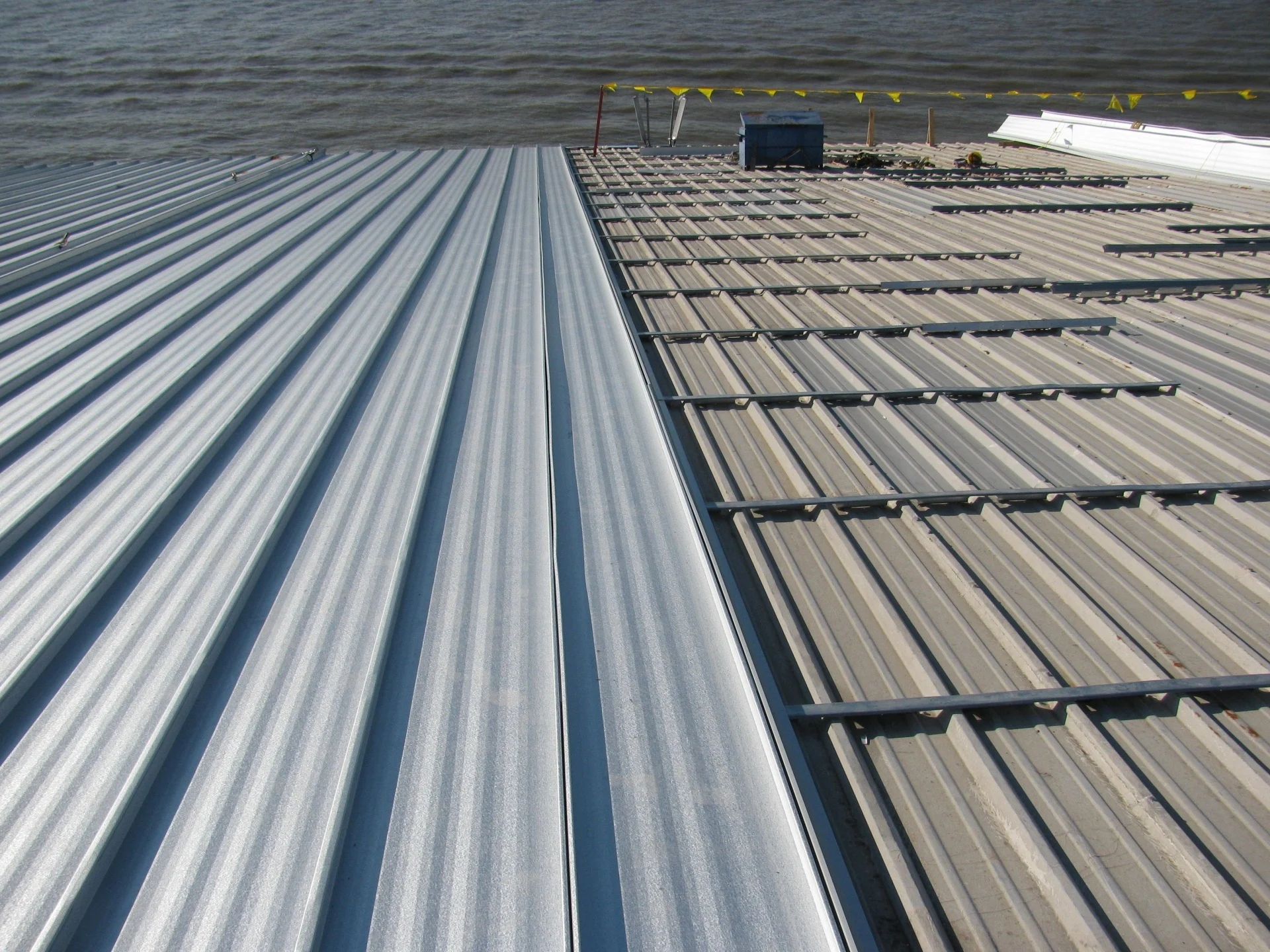
Send one inspector out to walk a 250,000-square-foot distribution roof off Pena Boulevard with a moisture meter and a clipboard, and you get an honest half-day of guesswork. The far bays get skipped, the ponding spots read dry on a sunny afternoon, and every step on a tired membrane is a small gamble in its own right. We fly those roofs instead. A drone carrying a high-resolution visible camera and a radiometric thermal sensor sweeps the entire field at one fixed altitude, records every drain sump, seam, curb, and penetration, and puts zero weight on a membrane whose condition nobody has confirmed yet. For the acre-scale flat roofs that define Denver's commercial inventory, flying it is simply the more thorough way to inspect.
The warehouse rows around Denver International Airport, the office and flex roofs strung along the I-25 corridor through the Denver Tech Center, the big-box retail centers, and the multi-building campuses across Central Park all share one trait: open acres of low-slope membrane where a foot survey is slow, partial, and rough on the roof. An aerial pass turns that into a systematic photographic and thermal record you can actually base a decision on.
Where the Thermal Camera Earns Its Keep
The single most valuable thing a Denver drone inspection produces is a moisture map. Wet insulation stores heat through the day and bleeds it off slowly after the sun drops, while the dry field around it cools faster. Fly the roof during that post-sunset cool-down with a calibrated radiometric sensor and the saturated zones light up warm against the cool field, even where the membrane surface gives away nothing from above. That thermal signature is the line between a roof you repair and a roof you replace.
This is the diagnostic behind the biggest call an owner has to make: targeted repair-and-recover versus full tear-off. A few isolated wet pockets around failed penetrations, and you cut them out and recover. Saturation bleeding across a quarter of the field, and recovering wet insulation in this climate is money set on fire. Denver's roughly 90 to 110 freeze-thaw cycles a year turn trapped moisture into a pump that delaminates membranes, buckles cover board, and rusts the light-gauge steel decks under so much of the metro's 1970s and 1980s commercial stock. The thermal map shows you exactly how far that has progressed before you spend a dollar scoping the wrong fix.
Thermal work on a big roof is genuinely a job for the aircraft. A handheld camera sees a few squares at a time and never assembles the wall-to-wall picture; the drone stitches the whole field into one georeferenced moisture survey in a single flight.
Storm Documentation Built for the Adjuster
Denver sits inside one of the most punishing hail corridors in the country, and the Front Range hail season from roughly May into August reliably drops stones big enough to bruise a membrane and dent rooftop equipment. After a storm, the package you put in front of the adjuster decides how the claim lands. We fly the roof and produce a GPS-tagged record an adjuster can review from a desk: strike locations and density, wind-peeled or displaced membrane, lifted edge metal, and battered HVAC curbs and condenser fins.
- Geotagged imagery tying every documented hail strike to a precise roof coordinate.
- Strike-density mapping that supports a full-roof claim instead of a few spot repairs.
- Wind-damage patterns showing membrane displacement and perimeter metal lift.
- Equipment and penetration damage captured in the same flight.
We format the report the way commercial property carriers expect to receive it, and on a documentation-only post-storm flight we can usually turn it around within a day, so you are not stuck waiting on paperwork while a compromised roof keeps taking weather.
Measuring a Roof Before Anyone Bids It
Before we or any other contractor writes a reroof proposal, an aerial survey pins down the variables that drive cost and breed change orders. The drone confirms actual roof area, finds and counts every penetration and equipment curb, and documents existing conditions against the spec. Bidding from measured reality instead of a rough walkover knocks down the RFIs and change orders that routinely blow up commercial reroof budgets, because the drawings finally match the roof that is actually up there.
Flying Legal in Denver's Airspace
The airspace over the Denver metro is not open territory. Denver International Airport, Centennial Airport in the south suburbs, Rocky Mountain Metropolitan to the northwest, and Buckley Space Force Base out in Aurora all throw controlled airspace across the map, and a real share of the metro's commercial roofs fall inside it. Every flight we run is flown by an FAA Part 107 certificated remote pilot, and where a roof sits in controlled airspace we pull LAANC authorization before the aircraft leaves the deck. We also fly to the realities of altitude: thinner air at a mile high shortens battery endurance, and the gusty downslope winds the Front Range is famous for set hard limits on when a flight is both safe and accurate. We will not put an aircraft over an occupied building in conditions that wreck the data or endanger the people below.
What Lands on Your Desk
A drone inspection from us is not a folder of scenic photos. It is a decision document: a visible-light condition record of the whole roof, a thermal moisture map keyed to roof locations, an inventory of penetrations and equipment, and a written read on whether the roof points toward maintenance, partial recover, or replacement. On a storm claim that same dataset becomes the evidence file for the adjuster. Either way you come away knowing the true state of an asset you normally only ever see from the parking lot.
Common Questions About Drone Roof Inspection
Why is flying it better than walking it?
It covers the entire surface systematically at one altitude and builds a complete photographic and thermal record, with no foot traffic on a membrane whose condition is still unknown. On a big low-slope roof a walkover burns hours, misses ponding invisible from standing height, and cannot generate a wall-to-wall thermal moisture map. The drone can.
Does thermal imaging really reveal trapped water?
Yes, when it is flown right. The standard protocol is an evening pass during the post-sunset cool-down: wet insulation holds heat longer than the dry field around it and reads as a clear infrared signature. That map is reliable enough to drive the repair-versus-replace decision.
Can I hand the footage to my insurer?
That is one of the main reasons owners call after a Front Range storm. We produce a GPS-tagged report documenting strike density, wind-displacement patterns, and equipment and flashing damage, formatted to match what commercial carriers expect and ready to pass straight to the adjuster.
| Scope Format | Written roof plan and photo record |
|---|---|
| Primary Market | Denver commercial buildings |
Commercial Re-Roofing in Denver, CO
Commercial Re-Roofing for commercial buildings across Denver.